Illinois, Indiana, Wisconsin, Minnesota, Ohio Under Severe Weather Threat
he Midwest is facing a critical weekend as flash flood warnings, heat advisories, and severe thunderstorm watches sweep across Illinois, Indiana, Wisconsin, Minnesota, and Ohio. Weather radar imagery lights up with turbulent storms, while millions brace for the combination of dangerous flooding and oppressive heat. In this extensive analysis, we’ll break down the causes, impacts, and safety tips amid the region’s weather emergency.
1. Midwest Weather at a Glance: August 2025
As August 2025 peaks, a perfect storm of atmospheric instability has set the stage for Midwest weather emergencies. Meteorologists report that:
- 14 million people in parts of Illinois, Indiana, Wisconsin, Minnesota, and Ohio remain under risk for flash floods and severe storms this weekend.
- Recent rain and humidity have pushed “heat index” values above 105°F, with local readings approaching 112°F in the Central Plains and Midwest.
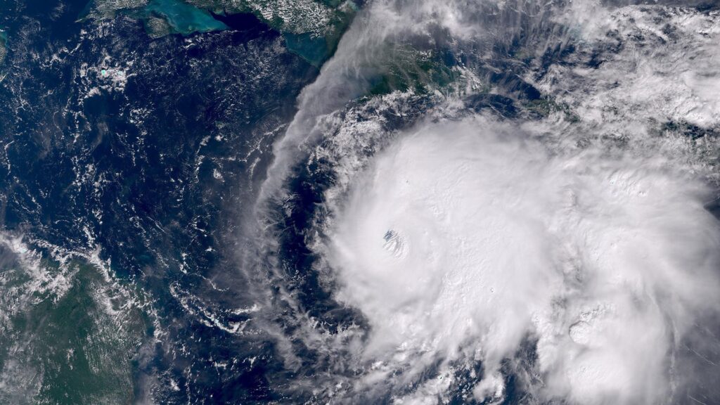
- Weather radar today shows a complex pattern of moving storm cells, pop-up flash flood warnings, and pockets of high heat across the region.
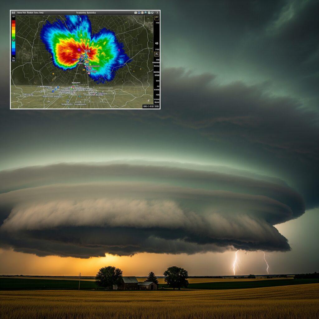
2. While the Radar Lights Up: Understanding Weather Radar and Today’s Forecasts
Weather radar is the primary tool used by meteorologists to track current storms. Today’s radar readings across the Midwest reveal:
- Large storm systems traversing Minnesota to Wisconsin, moving eastward into Illinois and Indiana.
- Storm cells producing wind gusts up to 80mph and hail up to 1.5in diameter in some locales.
- Persistent clusters of rainfall triggering flash flooding, especially in southern Wisconsin and the greater Milwaukee area.
Radar updates are available via National Weather Service and local news stations, showing real-time storm locations so residents can act fast.
3. Flash Flood Warnings: What Is Happening?
The National Weather Service has issued multiple flash flood warnings as:
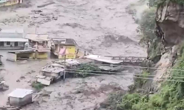
- Storms dump 5in to a foot of rain in places like Milwaukee, flooding homes, toppling trees, and stranding drivers.
- Some regions report rainfall rates of 3–4in per hour, quickly overwhelming drains and waterways.
- Nearly 3,600 flash flood warnings have already been issued nationwide this year, nearing annual averages by late July.
Flood Watches are in effect in southern Wisconsin (Milwaukee), Minnesota, and expanding into parts of Illinois and Indiana. The severity results from stationary cold fronts causing repeated bouts of heavy rain.
4. Heat Advisory: Danger from Above and Below
Combined with torrential rain, extreme heat creates an added layer of risk:
- Heat advisories remain in effect for much of the Midwest: northern Illinois, southwestern Indiana, Wisconsin, and surrounding areas.
- Heat index values soar to 110–115°F in urban areas like Chicago and St. Louis, bringing threat of heat exhaustion, dehydration, and heat stroke for workers, children, and the elderly.
- Forecasts predict more than 56 million Americans are under heat alerts across 15 states.
Wet-bulb temperatures (a measure of heat plus humidity) may make it harder for the body to cool down, especially after storm passages.
5. Severe Thunderstorm Watch & Warning Explained
Meteorologists distinguish between watches and warnings when severe weather is expected:
- Severe Thunderstorm Watch: Conditions are favorable for severe weather, including damaging winds, hail, and possible tornadoes. Residents should stay alert and ready for quick changes.
- Severe Thunderstorm Warning: Severe storms are occurring or imminent. Immediate action should be taken—seek shelter, avoid travel, and monitor updates closely.
- Today’s warnings cover Illinois, Indiana, Wisconsin, Minnesota, and Ohio, with specific alerts issued for southern Wisconsin and northern Illinois until 7 p.m. Saturday.
6. Regional Breakdown: State-by-State Impact
Illinois
- Flash flood risk highest: Central and northern areas, especially around Chicago.
- Streets and highways have experienced rapid flooding, with state emergency services responding to stranded motorists.
- Heat advisories remain, especially for urban and suburban zones.
Indiana
- Heavy rain bands sweep through northern and central Indiana, with local flooding in urban centers.
- Counties near the Illinois border are especially vulnerable, facing repeated flash flood events and heat stress concurrently.
Wisconsin
- Southern Wisconsin, especially Milwaukee, faces the brunt of heavy rain, flash floods, and damaging wind events.
- Statewide flood watches and warnings prompt shelter openings and advisories to avoid low-lying areas.
Minnesota
- Storms cross central and eastern Minnesota, bringing large hail, wind gusts, and flash floods.
- Radar shows additional cells expected to form and move east through the weekend.
Ohio
- While rainfall is less intense than farther west, eastern and southern Ohio face flash flood watches as storms move through, particularly in urban areas along rivers.
- Heat advisories extend through much of the state, exacerbating risk from power outages and high humidity.

7. Safety Tips during Severe Weather & Flood Risk
Follow these guidelines if you are in a warning zone:
- Monitor local weather radar and updates regularly.
- If a flash flood warning is issued, move to higher ground immediately.
- Never drive through flooded streets—“Turn Around, Don’t Drown.”
- Prepare a severe weather safety kit: charged phone, bottled water, flashlight, and first aid.
- Pay attention to severe thunderstorm watches and warnings—seek shelter in an interior room on the lowest floor.
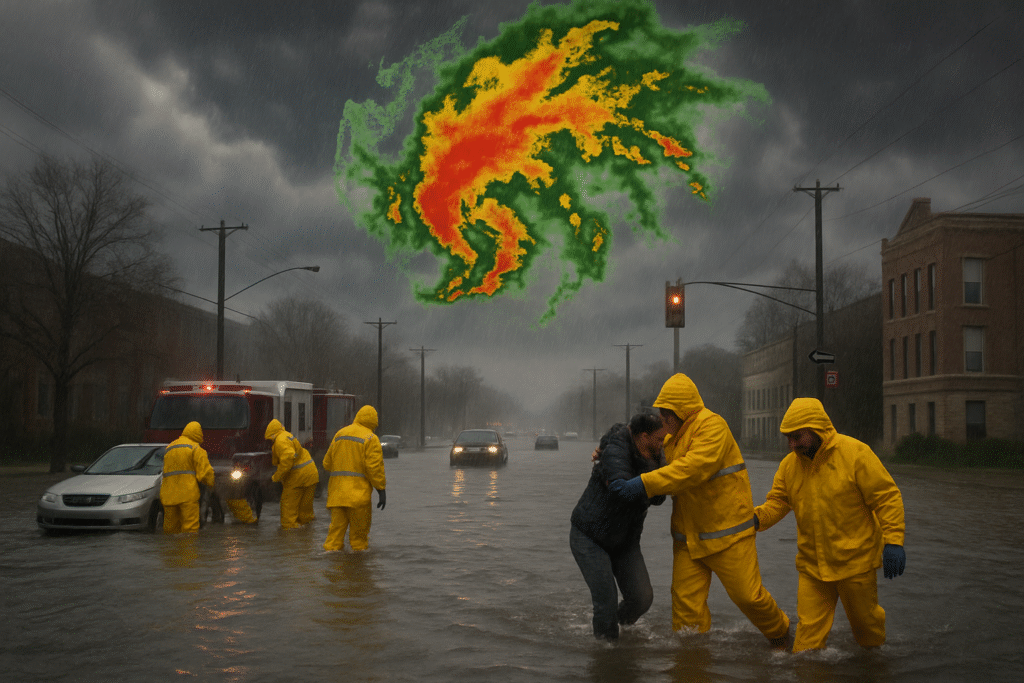
8. Community Response and Emergency Services
Local authorities across the Midwest are mobilizing:
- Emergency crews are rescuing stranded motorists and assisting residents in flooded homes.
- Community shelters are opening in areas under severe thunderstorm warning or flash flood watch.
- Public health agencies urge caution for individuals exposed to high heat or humid outdoor conditions.
9. Climate Change: Are Extreme Midwest Storms Becoming More Common?
2025 is already trending as one of the busiest years for flash flood and severe weather warnings in U.S. history. The pattern of increasingly slow-moving, rain-laden storms, coupled with warmer, moisture-rich air, suggests that:
- Extreme precipitation events are increasing in frequency and intensity.
- Heat waves are becoming longer and more severe, straining infrastructure and health services.
- Researchers note that shifts in jet stream patterns tied to climate change may be contributing to the uptick.
10. Final Tips: What You Should Do Today
Act quickly to stay safe:
- Check the latest weather radar and official alerts for your region.
- Limit outdoor activity during heat advisory periods.
- Prepare your home—clear gutters, secure outdoor items, stock emergency supplies.
- Reach out to neighbors, especially seniors, to ensure they’re aware of weather risks.
- Follow evacuation and emergency instructions if issued by local authorities.
As flash flood warnings continue across Illinois, Indiana, Wisconsin, Minnesota, and Ohio, staying vigilant and prepared is essential. Severe thunderstorm watches and heat advisories compound the risk; use your local weather radar and heed warnings to protect yourself and your community in this unprecedented Midwest weather event.